


المياه : تحديث قاعدة بيانات جغرافية لأولويات الصرف الصحي في المملكة بالتعاون مع بوردا
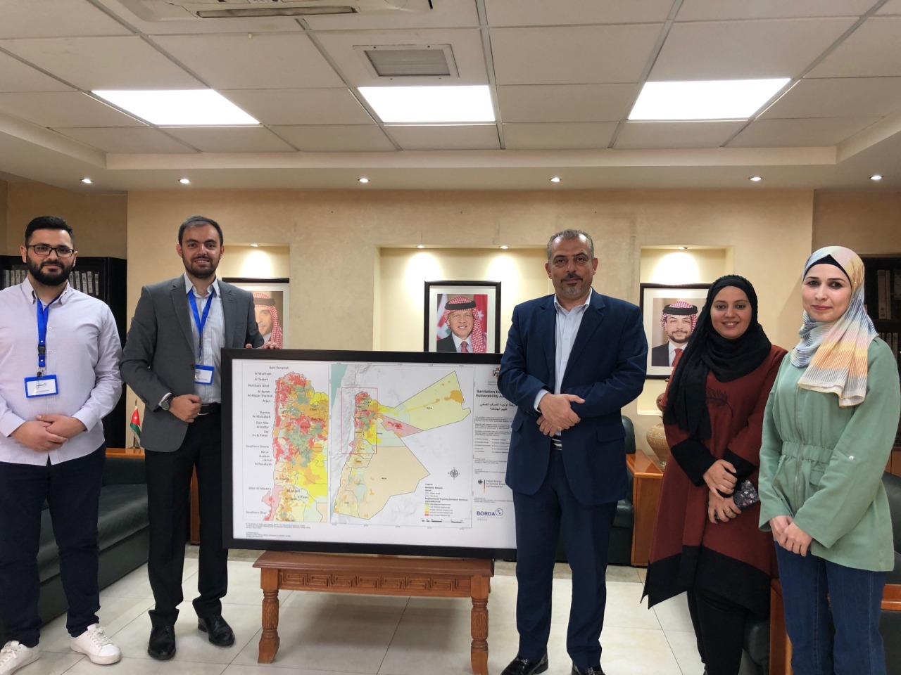
في اطار التعاون ما بين وزارة المياه والري /سلطة المياه مع منظمة بوردا الألمانية – مكتب الأردن تم عمل دراسة حديثة وبناء قاعدة بيانات جغرافية محدثّة (Geodatabase) وإنشاء خريطة أولوية الصرف الصحي – تقييم الهشاشة (Sanitation Hotspots map – Vulnerability Assessment) لتحديد المناطق ذات الأولوية في حلول الصرف الصحي المركزية وغير مركزية على مستوى الأحياء في المملكة كافة، عن طريق تقييم الوضع البيئي والصرف الصحي الحالي وتحليل المؤشرات باستخدام نظم المعلومات الجغرافية.
وتعد هذه الخريطة هي أداة مهمة تدعم توجه صانعي القرار في الجهات الحكومية والخاصة والجهات المانحة والمنظمات الدولية في تخطيط وتنفيذ مشاريع حلول الصرف الصحي على أساس الحاجة والأولويات .
MWI, updated geographical database (Geodatabase) for “Sanitation Hotspots Map”
Ministry of Water and Irrigation (MWI) and the Water Authority of Jordan (WAJ) in cooperation with BORDA Jordan , has studied and built an updated geographical database (Geodatabase) and created a “Sanitation Hotspots Map - Vulnerability Assessment” to identify priority areas that require centralized and decentralized sanitation solutions at the neighborhood level across the Kingdom by assessing the current environmental and sanitation situation and analyzing indicators using Geographic Information Systems (GIS).This map is an important tool that supports and guides decision-makers in government and private agencies, donors and international organizations in planning and implementing sanitation solutions projects based on need and priority.